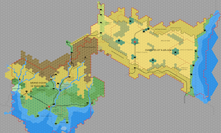
Draft of Karameikos and Ylaruam at 8, 24 and 72 mph
One of my main gripes of the original TSR maps, was the way positions of rivers and coastlines moved between the different scales and products.
The original work conceived in no small part in an attempt to reconcile this issue, but unfortunately given the methods I was using, it was too much at the time.
However, with the new processes, I can now work on this basis. It's little fiddly, but it works. To show how this works, below are the Karameikos and Ylaruam regions at 8, 24 and 72 mph.
- 8mph
- 24mph
- 72mph
Also, to try and illustrate the differences between the two at the 72 mph level, I've included a partial transparency.
I'm sure these matters have come up many times over the years, but I'll predominantly take the 8mph (Gaz/TM) coasts and rivers as valid.


Comments
Post a Comment