Posts

Showing posts from November, 2018

Old Maps Part 4 - Isle of Dawn

Image
These Isle of Dawn maps were nearly completed when I abandoned this project in 2006. Primary sources were the Trail Maps and the DoTE box set. 24 miles per hex: 8 miles per hex: There are other far more incomplete areas that I many post in the near future, but these are far more rough

Draft of Karameikos and Ylaruam at 8, 24 and 72 mph

Image
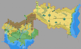
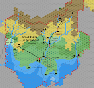
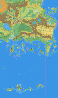
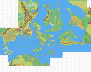
One of my main gripes of the original TSR maps, was the way positions of rivers and coastlines moved between the different scales and products. The original work conceived in no small part in an attempt to reconcile this issue, but unfortunately given the methods I was using, it was too much at the time. However, with the new processes, I can now work on this basis.  It's  little fiddly, but it works.  To show how this works, below are the Karameikos and Ylaruam regions at 8, 24 and 72 mph. 8mph 24mph 72mph Also, to try and illustrate the differences between the two at the 72 mph level, I've included a partial transparency. I'm sure these matters have come up many times over the years, but I'll predominantly take the 8mph (Gaz/TM) coasts and rivers as valid.

Karameikos - Draft

Image
The second part of this current project is to update the previous work into artwork and process.  The old process was very long and laborious, being effectively done in MSPaint. I'll be initially covering the the Known World first, but will be expanding off at various points. Here is the first draft of a map of Karameikos at 8 miles per hex.  As you can probably tell, this is a part of a larger piece, but I'm still perfecting the underlying artwork and the use of the software.

Old Maps - Part 3. Mystara at 8 miles per hex

Image
Another from 2005.  This is the region shown in X1 at 8 miles per hex. This was created from a number of sources, all the Gazetteers, X1, and the Trail Maps.  The most notable thing to come from putting this together was the discrepancies around the Isle of Dread, the size of the island in the 24 mile map of X1 not matching up with the 6 mile map in the same module.

Old Maps - Part 2. Mystara at 24 miles per hex

Image
Again from 2005.  The Known World at 24 miles per hex. This was created from the 24 mph map in WoTI, but shifted back 1000AC.

Old Maps - Part 1. Mystara at 72 miles per Hex

Image
This was created back in 2005, using the 72 mile per hex maps published in the Dawn of the Emperors box set and the Poor Wizard's Almanacs.  And was supposed to be the top layer of a consistent mapping at 72 miles, 24 miles and 8 miles per hex, as there are significant differences between the different levels. Ultimately this project only got so far and was abandoned in 2006, but with more time, and better software, I am looking to restart this project.