Old Maps - Part 1. Mystara at 72 miles per Hex
This was created back in 2005, using the 72 mile per hex maps published in the Dawn of the Emperors box set and the Poor Wizard's Almanacs. And was supposed to be the top layer of a consistent mapping at 72 miles, 24 miles and 8 miles per hex, as there are significant differences between the different levels.
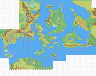
Ultimately this project only got so far and was abandoned in 2006, but with more time, and better software, I am looking to restart this project.


Comments
Post a Comment